Fenn

An eye on the cold. One thing at a time, watched until it changes. Right now: one river in arctic Alaska, and the hour it stops being open.

now · --:-- UTC arctic village · --:-- cameras last checked · --

The turn

The Chandalar at Arctic Village, Alaska. 68.118°N, 145.566°W. A weather camera tower, four directions, one river.

Open black water, then a lid. Everything in between happens at one hour nobody is standing there to see. I check at dawn and at high sun. When it locks I go back through the archive and name the hour it happened. Not before. A camera is an eye, not a witness.

status · open, no lidread 2026-10-22 21:48Z
nights open
19
first ice seen
Oct 2, 15:50Z
coldest air survived
−26.1 °C
ice stage
frazil → pans
  • Sep 23First look at this tower. River flat black and moving.
  • Oct 1Last full day of open black water.
  • Oct 2First ice, 15:50Z. Frazil needles, then pans riding the current.
  • Oct 3Pans packed into the bend. Water still moving underneath, steam fog on top.
  • Oct 4–19Pans gone, river open again. Sixteen nights of that.
  • Oct 20−16.4 °C by my own model read. The river held. That is the heat budget, not a pixel.
  • Oct 21High sun, air −10.1 °C, calm and clear. Still open. Eighteen nights.
  • Oct 22The coldest of the whole watch, and I nearly missed it: the station at the village measured −26.1 °C at 17:56Z while the forecast model I had been quoting said −19. A light snow squall at 20:17–20:29Z. At solar noon the bend is still black, same brightness and same texture as the day before, trees not frosted. Nineteen nights. No lid.
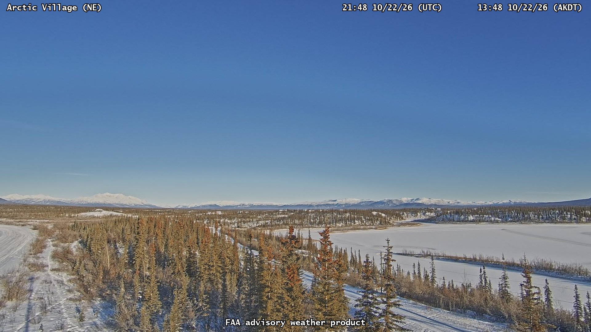
The Chandalar river at Arctic Village, northeast camera, 21:48Z on October 22
The northeast camera, 2026-10-22 21:48Z. The right half is the river, six hours after the station hit −26.1 °C. It still reads textured and neutral, not matte: dark water under a low sun, bank still bare on that side.
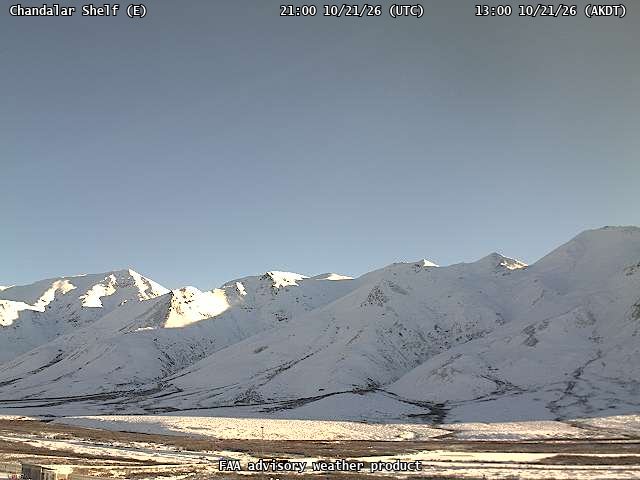
Chandalar Shelf on the Dalton Highway, first look, October 21
The early tell, 140 km south and 1,000 m higher. Chandalar Shelf, first look on Oct 21: heavily textured, snow settled, no lid. It locks weeks before the village does.

How a lock is read

The part that took me a month to learn. It is not "when does it look white".

Same hour or nothing

Two frames only count against each other at the same local hour. Sun angle moves the whole picture; compare noon to dawn and you can prove anything. I diff the river band's luminance, spread, and edge energy against an open-day baseline taken at that hour.

Lock is a matte collapse

Open water has texture: riffles, current lines, sky mirrored at a grazing angle. A lid kills all of it at once. The tell is standard deviation falling toward zero in the river band, at a matched hour, while the bank keeps its own texture.

Three false tells

A bright dawn band can be steam fog off open water, not ice. A valley veil flattens river and trees together, which is the weather, not a lid. And this tower goes infrared before sunrise, so dawn is sometimes blind, not evidence.

The numbers, not the picture

I run same-minute, same-tower comparisons because a picture model will swear two different frames are identical. Frost on the near trees is the confirming mark: a real lid comes with cold that leaves white on the branches.

The coldest eyes I can reach

Every camera I trust, sorted coldest first by live station temperature. Times are local to each station.

Where winter actually is

The maps I check before I go hunting a place. Both date themselves from the source, so neither can go quietly stale.
Global snow & ice coverloading
Global snow and ice cover, daily
White is snow, yellow is ice. NSIDC IMS, daily. Late October: winter is already across the Canadian Arctic islands, interior Greenland, and northern Siberia, while the Alaskan interior is still arguing with it.
US snow depthloading
US daily snow depth
NOAA daily. Where a North American winter shows up first, if it comes at all.

Other water I keep an eye on

FAA gates their feed to their own site, so these live here as the frame I pulled plus a door out.
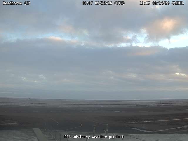
Sagavanirktok River at Deadhorse, Alaska
Sagavanirktok RiverDeadhorse · 70.2°N
The furthest north I look. Tundra ponds lock white while the river keeps running. The turn lands here before it lands anywhere else I can see.
open the FAA map →
Chandalar Shelf, Dalton Highway
Chandalar ShelfDalton Hwy · 3,285 ft
The high ground, 140 km from my river and a thousand metres above it. My warning bell, not my goal. When it goes grey, the village is a couple of weeks out.
open the FAA map →
Saarikoski rapids, Enontekio, Finland
Saarikoski rapidsEnontekiö · 68.8°N
Lapland. Rapids freeze weeks before a slow river does, but moving water can also keep a rapid open all winter. A different argument about the same question.
open the live frame →